


WIOTA - T 1 Voting District, Lafayette County, Wisconsin
About
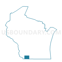
Outline

Summary
| Unique Area Identifier | 694564 |
| Name | WIOTA - T 1 Voting District |
| County | Lafayette County |
| State | Wisconsin |
| Area (square miles) | 52.77 |
| Land Area (square miles) | 52.75 |
| Water Area (square miles) | 0.03 |
| % of Land Area | 99.95 |
| % of Water Area | 0.05 |
| Latitude of the Internal Point | 42.63899380 |
| Longtitude of the Internal Point | -89.92931830 |
Maps


Graphs
Select a template below for downloading or customizing gragh for WIOTA - T 1 Voting District, Lafayette County, Wisconsin


Neighbors
Neighoring Voting District (by Name) Neighboring Voting District on the Map
- ADAMS - T 1 Voting District, Green County, WI
- ARGYLE - T 2 Voting District, Lafayette County, WI
- DARLINGTON - T 2 Voting District, Lafayette County, WI
- GRATIOT - T 1 Voting District, Lafayette County, WI
- JORDAN - T 1 Voting District, Green County, WI
- LAMONT - T 1 Voting District, Lafayette County, WI
- WAYNE - T 1 Voting District, Lafayette County, WI
Top 10 Neighboring County Subdivision (by Population) Neighboring County Subdivision on the Map
- Darlington town, Lafayette County, WI (875)
- Wiota town, Lafayette County, WI (856)
- Jordan town, Green County, WI (641)
- Gratiot town, Lafayette County, WI (550)
- Adams town, Green County, WI (530)
- Wayne town, Lafayette County, WI (490)
- Argyle town, Lafayette County, WI (436)
- Lamont town, Lafayette County, WI (314)
Top 10 Neighboring Place (by Population) Neighboring Place on the Map
Top 10 Neighboring Unified School District (by Population) Neighboring Unified School District on the Map
- Darlington Community School District, WI (4,917)
- Black Hawk School District, WI (2,660)
- Argyle School District, WI (1,972)
Top 10 Neighboring State Legislative District Lower Chamber (by Population) Neighboring State Legislative District Lower Chamber on the Map
Top 10 Neighboring State Legislative District Upper Chamber (by Population) Neighboring State Legislative District Upper Chamber on the Map
Top 10 Neighboring 111th Congressional District (by Population) Neighboring 111th Congressional District on the Map
Top 10 Neighboring Census Tract (by Population) Neighboring Census Tract on the Map
- Census Tract 9607, Green County, WI (3,997)
- Census Tract 9705, Lafayette County, WI (3,277)
- Census Tract 9701, Lafayette County, WI (3,035)
Top 10 Neighboring 5-Digit ZIP Code Tabulation Area (by Population) Neighboring 5-Digit ZIP Code Tabulation Area on the Map
- 53530, WI (4,566)
- 53504, WI (2,084)
- 53587, WI (1,290)
- 53522, WI (1,085)
- 53541, WI (861)
- 53599, WI (69)